
 Cryptogamie, Algologie
35 (1) - Pages 49-65
Cryptogamie, Algologie
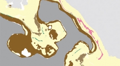
35 (1) - Pages 49-65Bahía Concepción was once recognized as a very productive coastal lagoon not only for the Peninsula of Baja California but also for all Mexico. However, lack of proper management has resulted in the closure of various fisheries, such as the Calico scallop, Argopecten ventricosus, in 1994. One of the main challenges for the management of coastal resources is the selection of critical habitats for conservation considering the economic activities of the communities associated with them. This study used Geographic Information Systems (GIS) and remote sensing to assess the roll of rhodoliths and Sargassum spp. as critical habitats in Bahía Concepción for endangered and commercial species. Underwater surveys, on 72 randomly selected sites within the bay, were conducted to characterize the shallow benthic habitats, fish and invertebrate species abundance and richness during the spring of 2011. Analyses show that rhodoliths are important for the invertebrate assemblages and for at least 4 species protected under the Mexican law, NOM-059, for threatened species. Sargassum spp. and seagrass beds are also relevant for diversity but their annual life cycle limits the time when these are available as habitat for other species. GIS tools proved an innovative and effective method to provide essential information to protect critical habitats such as rhodoliths, Sargassum spp. and seagrasses, for the recovery and conservation of diversity.